Airport Weather › SHV
SHV Weather: METAR, TAF and Runway Winds
Shreveport Regional Airport, Shreveport, LA · KSHV
Current weather at Shreveport Regional Airport in Shreveport, LA (IATA SHV, ICAO KSHV): the latest observation puts the airport in VFR (visual flight rules) conditions, wind calm. Below are the latest METAR and TAF from the NOAA Aviation Weather Center, decoded into plain English, and the headwind and crosswind on each runway.
Weather radar
Current conditions (METAR)
- Wind: calm.
- Visibility: 8 miles.
- Weather: no rain, snow, fog or other weather reported.
- Clouds: none reported; no ceiling.
- Temperature: 9°C (48°F), dew point 9°C (48°F).
- Altimeter: 29.95 inHg (1014 hPa).
METAR KSHV 051256Z 00000KT 8SM CLR 09/09 A2995 RMK SLPNO
Runway winds
The wind is calm: no headwind or crosswind on any runway.
| Runway | Heading (true) | Headwind | Crosswind | Length |
|---|---|---|---|---|
| 06 | 061° | – | – | 7,003 ft |
| 24 | 241° | – | – | 7,003 ft |
| 14 | 143° | – | – | 8,348 ft |
| 32 | 323° | – | – | 8,348 ft |
Forecast (TAF)
Issued , valid to
TAF KSHV 051120Z 0512/0612 00000KT P6SM SKC TEMPO 0512/0513 3/4SM BR FM051500 VRB05KT P6SM FEW250 FM060000 36003KT P6SM SCT250
- toWind calm; visibility 6 miles or more; clear skies.
- Temporarily, toVisibility 3/4 mile; mist.
- From (until )Wind variable at 5 kt; visibility 6 miles or more; few clouds at 25,000 ft.
- From (until )Wind 360° at 3 kt; visibility 6 miles or more; scattered clouds at 25,000 ft.
Airport diagram
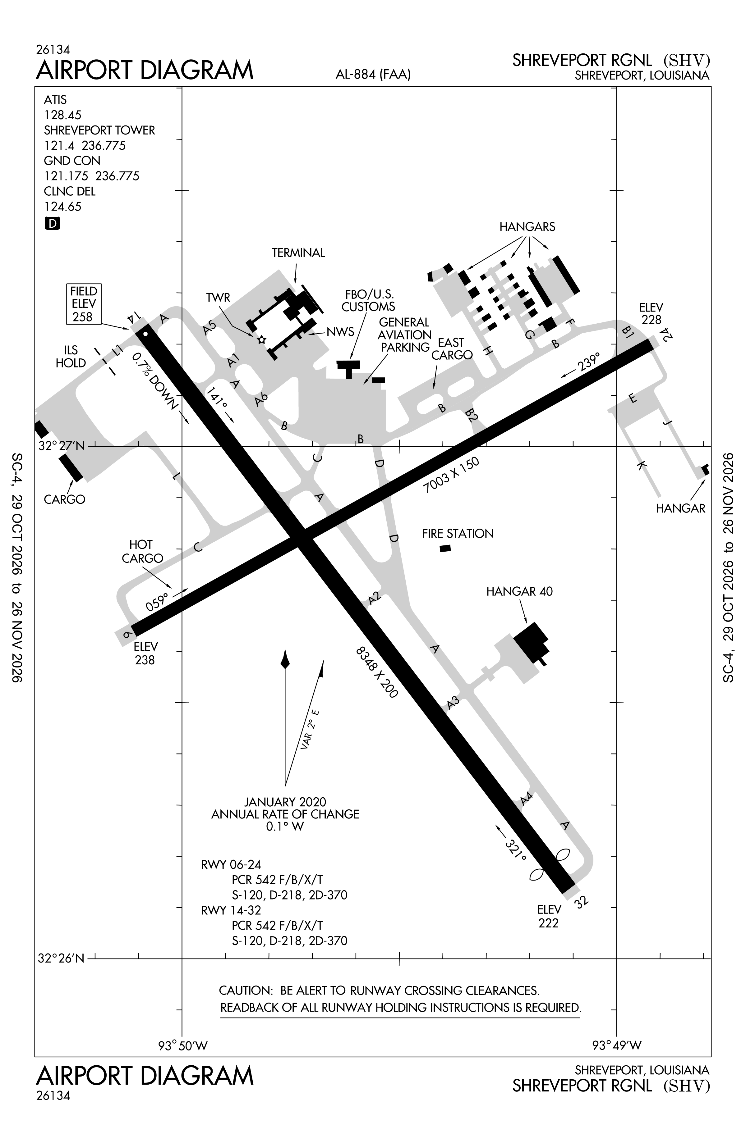
Official FAA PDF (effective Oct 29 to Nov 26)
FAA airport diagram, cycle 2611, effective Oct 29 to Nov 26, 2026. Reference only, not for navigation.
FBOs and services
FBOs
 Signature Shreveport6209 Interstate Drive, Shreveport, LA 71109+1 318-636-1000Hours: 24 hours a day/7 days a weekUNICOM 130.07Signature pageSource: Signature Aviation
- TAC AirBrand website
FBO locations from OpenStreetMap and the operators' own sites, community-maintained or operator-published and may be out of date. Call ahead to confirm services and hours.
Not listed? The FBO may not be in OpenStreetMap. Send a correction.
Data © OpenStreetMap contributors (ODbL), as of Nov 3, 2026; Signature Aviation locations, as of Nov 5, 2026.
Related
- KSHV weather with live refresh
- METAR and TAF decoder: read any report in plain English
- Shreveport Regional Airport: codes, map and radar
- Current NOTAMs for SHV
- Flights at SHV now
- Weather for other airports
More airport weather in Louisiana
Times are UTC (Z); the time after a slash is the local time at the airport. Weather and runway data come from the NOAA Aviation Weather Center (aviationweather.gov) and are refreshed here every few minutes; the plain-English summaries are generated by cwsi.net and may simplify, so the raw METAR and TAF are authoritative. Runway headings are true, worked out from NOAA's runway alignment. cwsi.net is not affiliated with NOAA or the FAA: get an official weather briefing before flight.