MKG NOTAMs
Muskegon County Airport, Muskegon, MI · KMKG
Muskegon County Airport in Muskegon, Michigan (IATA MKG, ICAO KMKG) has 17 current NOTAMs (Notices to Air Missions): 17 in effect now and 0 starting later. By category: procedures (6), runways (5) and taxiways (3). The list comes from the FAA NOTAM Management Service, refreshed by cwsi.net every few minutes; each NOTAM shows its number, category, start and end time in UTC, and a plain-English reading.
- Procedures6
- Runway5
- Taxiway3
- Apron1
- Navaid1
- Obstacle1
In effect now (17)
RWY 14 FICON 5/5/5 75 PCT WET OBS AT 2611051713. 2611051713-2611061713
TWY ALL FICON PATCHY WET OBS AT 2611051659. 2611051659-2611061659
RWY 24 FICON 5/5/5 50 PCT WET OBS AT 2611051521. 2611051521-2611061521
TWY ALL FICON PATCHY WET OBS AT 2611051521. 2611051521-2611061521
RWY 14 FICON 5/5/5 100 PCT WET OBS AT 2611051506. 2611051506-2611061506
APRON ALL FICON PATCHY WET OBS AT 2611051457. 2611051457-2611061457
NAV ILS RWY 32 LOC/DME U/S 2611051409-2611201000
RWY 32 ALS U/S EXC MEDIUM INTST ON CONS 2611051400-2611052000
TWY H CLSD 2610311906-2701311200EST
RWY 24 VASI U/S 2610230120-2710312000EST
OBST TOWER LGT (ASR 1058013) 431320.70N0861106.90W (4.0NM NNE MKG) 847.1FT (206.0FT AGL) U/S 2609011416-2611301516
IAP MUSKEGON COUNTY, MUSKEGON, MI. ILS OR LOC RWY 24, AMDT 6... AUTOPILOT COUPLED APPROACH UNUSABLE BELOW 1150. 2605041417-2805041417EST
IAP MUSKEGON COUNTY, MUSKEGON, MI. RNAV (GPS) RWY 32, AMDT 2D... APT ELEV 628. TDZE 628. LPV DA/HAT 878/250 ALL CATS. LNAV/VNAV DA 914 ALL CATS. LNAV HAT 452 ALL CATS. CIRCLING CAT A HAA 452, CIRCLING CAT B HAA 552, CIRCLING CATS C/D HAA 572. CHANGE NOTE TO READ: FOR INOP ALS, INCREASE LNAV/VNAV VISIBLITY ALL CATS TO RVR 4500. DISREGARD NOTE: **RVR 1800 AUTHORIZED WITH USE OF FD OR AP OR HUD TO DA, NA WHEN USING FREMONT ALTIMETER SETTING. 2604231720-2804231720EST
IAP MUSKEGON COUNTY, MUSKEGON, MI. ILS OR LOC RWY 24, AMDT 6... S-ILS 24 DA/HAT 912/285 ALL CATS. S-LOC 24 MDA/HAT 1000/373 ALL CATS. 2604201849-2811301849EST
IAP MUSKEGON COUNTY, MUSKEGON, MI. RNAV (GPS) RWY 24, AMDT 2A... LPV DA/HAT 912/285 ALL CATS. 2604201849-2811301849EST
IAP MUSKEGON COUNTY, MUSKEGON, MI. ILS OR LOC RWY 32, AMDT 20A... S-ILS 32 DA/HAT 878/250 ALL CATS. 2604201849-2811301849EST
IAP MUSKEGON COUNTY, MUSKEGON, MI. RNAV (GPS) RWY 6, AMDT 2A... LNAV/VNAV DA 989/HAT 366 ALL CATS. 2506270844-2706270844EST
Airport diagram
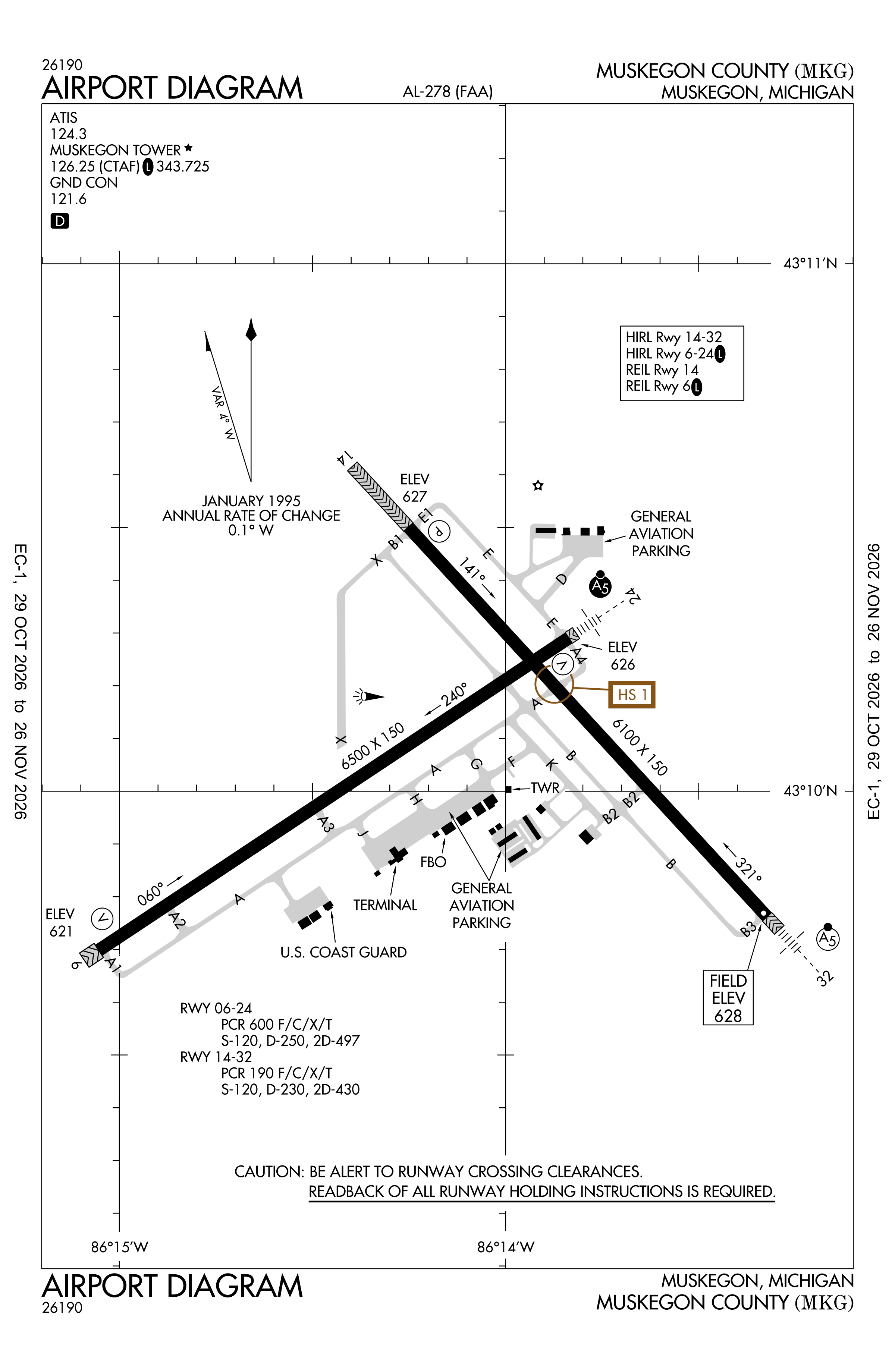
Official FAA PDF (effective Oct 29 to Nov 26)
FAA airport diagram, cycle 2611, effective Oct 29 to Nov 26, 2026. Reference only, not for navigation.
FBOs and services
FBOs
No FBOs are listed in OpenStreetMap for this airport.
Not listed? The FBO may not be in OpenStreetMap. Send a correction.
Data © OpenStreetMap contributors (ODbL), as of Nov 3, 2026.
Related
- Interactive NOTAM search for KMKG (category filters, maps, share links and a NOTAM decoder)
- Muskegon County Airport: codes, map and current weather
- MKG weather and runway winds (METAR and TAF in plain English)
- Flights at MKG now
- NOTAMs for other US airports
More NOTAMs in Michigan
Times are UTC (Z). Plain-English explanations are generated by cwsi.net from the NOTAM abbreviations and may simplify; the original NOTAM text is authoritative. NOTAMs come from the FAA NOTAM Management Service; cwsi.net refreshes its copy every 3 minutes. cwsi.net is not affiliated with the FAA: always confirm NOTAMs through official sources (a standard briefing or FAA NOTAM Search) before flight.