LEX NOTAMs
Blue Grass Airport, Lexington, KY · KLEX
Blue Grass Airport in Lexington, Kentucky (IATA LEX, ICAO KLEX) has 18 current NOTAMs (Notices to Air Missions): 15 in effect now and 3 starting later. By category: obstacles (12), services (3) and procedures (2). The list comes from the FAA NOTAM Management Service, refreshed by cwsi.net every few minutes; each NOTAM shows its number, category, start and end time in UTC, and a plain-English reading.
- Obstacle12
- Services3
- Procedures2
- Runway1
In effect now (15)
OBST TOWER LGT (ASR 1051840) 375615.00N0843209.00W (6.9NM SSE LEX) 1278.2FT (265.1FT AGL) U/S 2611161000-2612010900
OBST TOWER LGT (ASR 1221347) 375846.70N0842936.30W (6.4NM ESE LEX) 1183.1FT (270.0FT AGL) U/S 2611101214-2702081214
OBST TOWER LGT (ASR 1201302) 381008.10N0844022.20W (8.5NM NNW LEX) 1156.8FT (308.7FT AGL) U/S 2611091815-2702071815
OBST TOWER LGT (ASR 1207500) 375602.90N0843521.90W (6.2NM S LEX) 1256.6FT (275.6FT AGL) U/S 2611090804-2702070804
OBST TOWER LGT (ASR 1028248) 380503.00N0843712.30W (2.9NM N LEX) 1178.1FT (245.1FT AGL) U/S 2611042300-2702022300
SVC TAR/SSR U/S 2611031141-2701272100
OBST TOWER LGT (ASR 1044385) 380643.30N0843446.50W (4.7NM N LEX) 1227FT (321FT AGL) U/S 2610261945-2612110145
OBST TOWER LGT (ASN 2022-ASO-18787-OE) 380149N0843058W (4.4NM E LEX) 1139FT (153FT AGL) U/S 2610221212-2701202359
OBST TOWER LGT (ASR 1036190) 375718.90N0842255.00W (11.7NM ESE LEX) 1305.8FT (300.9FT AGL) U/S 2610151129-2701130400
OBST TOWER LGT (ASR 1036603) 380314.00N0844139.00W (4.2NM WNW LEX) 1212.9FT (297.9FT AGL) U/S 2609240419-2612230519
OBST TOWER LGT (ASR 1226298) 380728.20N0843618.50W (5.3NM NE LEX) 1184.7FT (299.9FT AGL) U/S 2609191114-2612181214
OBST TOWER LGT (ASR 1043360) 375545.80N0843330.50W (6.9NM SSE LEX) 1309.1FT (303.1FT AGL) U/S 2608231523-2611220400
OBST TOWER LGT (ASR 1210821) 375035.50N0844042.20W (12.1NM SSW LEX) 1278.2FT (325.1FT AGL) U/S 2608231508-2611220400
IAP BLUE GRASS, LEXINGTON, KY. RNAV (GPS) RWY 27, ORIG-B... LPV DA 1374/HAT 400. 2605281329-2805281329EST
IAP BLUE GRASS, LEXINGTON, KY. RNAV (GPS) RWY 27, ORIG-B... CIRCLING CAT A MDA 1440/HAA 460. 2605142043-2805142042EST
Starting later (3)
SVC SEE ZID 11/309 LEXINGTON APP CLSD DLY 0450-1110 2611230450-2611271110
SVC SEE ZID 11/309 LEXINGTON APP CLSD 2611200450-2611201110
RWY 04/22 CLSD 2611190530-2611191000
Airport diagram

FAA chart (PNG) Official FAA PDF (effective Oct 29 to Nov 26)
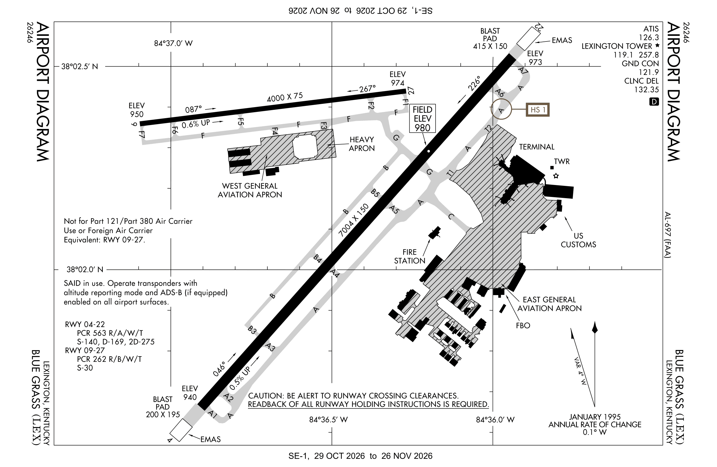
Redrawn by cwsi.net from the FAA airport diagram, cycle 2611, effective Oct 29 to Nov 26, 2026, and OpenStreetMap. Reference only, not for navigation.
FBOs and services
FBOs
 Signature Lexington4308 Hangar Drive, Lexington, KY 40510+1 859-255-7724Hours: 24 hours a day/7 days a weekARINC 129.875Signature page
- TAC AirBrand website
FBO details may be out of date. Call ahead to confirm services and hours.
Not listed? Send a correction.
As of Nov 3, 2026.
Related
- Interactive NOTAM search for KLEX (category filters, maps, share links and a NOTAM decoder)
- Blue Grass Airport: codes, map and current weather
- LEX weather and runway winds (METAR and TAF in plain English)
- Flights at LEX now
- NOTAMs for other US airports
More NOTAMs in Kentucky
Times are UTC (Z). Plain-English explanations are generated by cwsi.net from the NOTAM abbreviations and may simplify; the original NOTAM text is authoritative. NOTAMs come from the FAA NOTAM Management Service; cwsi.net refreshes its copy every 3 minutes. cwsi.net is not affiliated with the FAA: always confirm NOTAMs through official sources (a standard briefing or FAA NOTAM Search) before flight.