EAR NOTAMs
Kearney Regional Airport, Kearney, NE · KEAR
Kearney Regional Airport in Kearney, Nebraska (IATA EAR, ICAO KEAR) has 3 current NOTAMs (Notices to Air Missions): 3 in effect now and 0 starting later. By category: obstacles (3). The list comes from the FAA NOTAM Management Service, refreshed by cwsi.net every few minutes; each NOTAM shows its number, category, start and end time in UTC, and a plain-English reading.
- Obstacle3
In effect now (3)
OBST TOWER LGT (ASR 1231197) 404235.10N0990555.70W (4.3NM WSW EAR) 2575.8FT (315.9FT AGL) U/S 2611040526-2611190426
OBST TOWER LGT (ASN 2022-ACE-2892-OE) 404005N0990453W (4.9NM SW EAR) 2339FT (195FT AGL) U/S 2610300657-2612140657
OBST TOWER LGT (ASR 1214875) 404408.30N0984319.10W (13.0NM E EAR) 2263.8FT (255.9FT AGL) U/S 2608280202-2612260202
Airport diagram
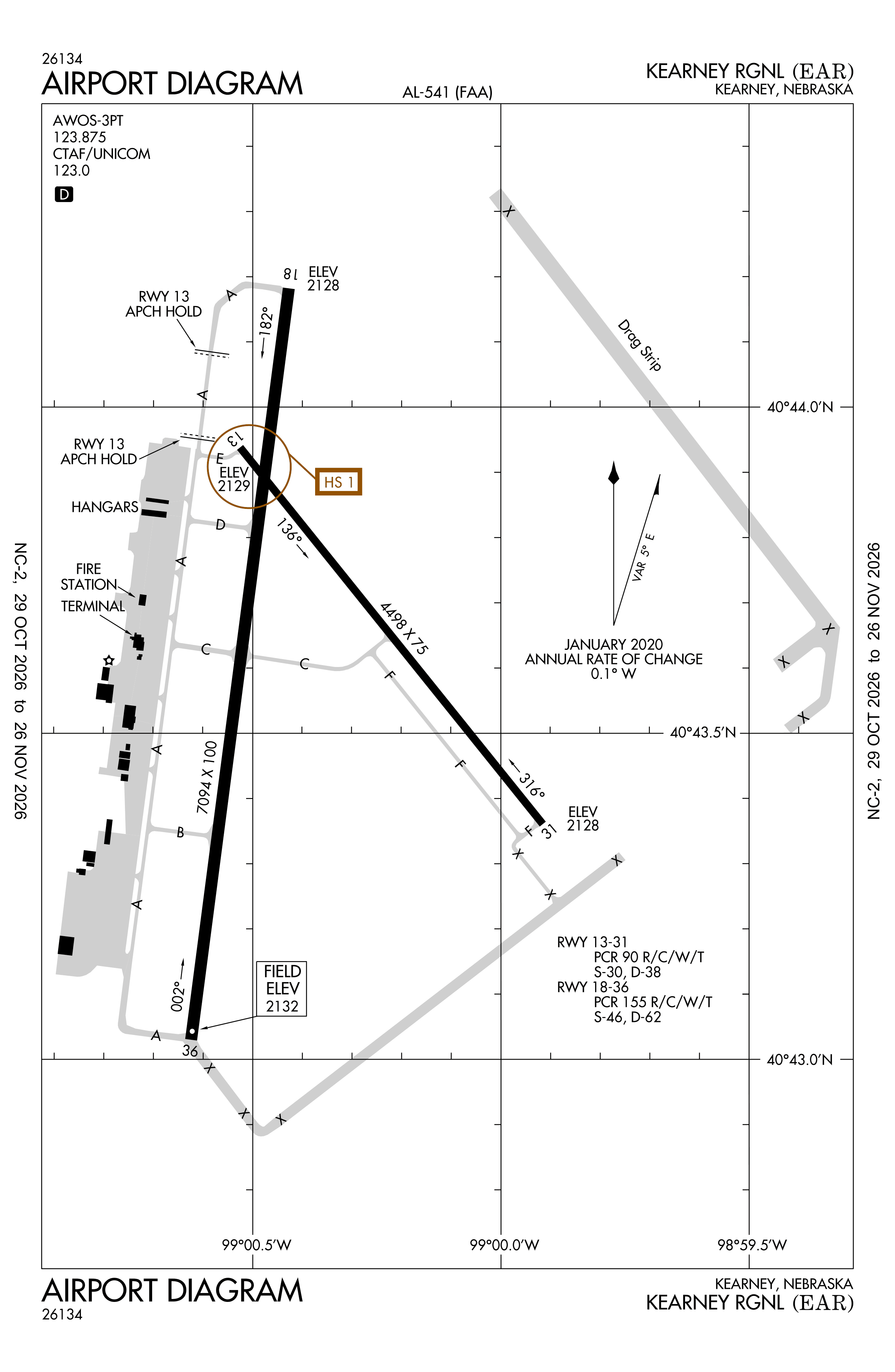
Official FAA PDF (effective Oct 29 to Nov 26)
FAA airport diagram, cycle 2611, effective Oct 29 to Nov 26, 2026. Reference only, not for navigation.
FBOs and services
FBOs
No FBOs are listed in OpenStreetMap for this airport.
Not listed? The FBO may not be in OpenStreetMap. Send a correction.
Data © OpenStreetMap contributors (ODbL), as of Nov 3, 2026.
Related
- Interactive NOTAM search for KEAR (category filters, maps, share links and a NOTAM decoder)
- Kearney Regional Airport: codes, map and current weather
- EAR weather and runway winds (METAR and TAF in plain English)
- Flights at EAR now
- NOTAMs for other US airports
More NOTAMs in Nebraska
Times are UTC (Z). Plain-English explanations are generated by cwsi.net from the NOTAM abbreviations and may simplify; the original NOTAM text is authoritative. NOTAMs come from the FAA NOTAM Management Service; cwsi.net refreshes its copy every 3 minutes. cwsi.net is not affiliated with the FAA: always confirm NOTAMs through official sources (a standard briefing or FAA NOTAM Search) before flight.